Deer Prairie Loop Trail

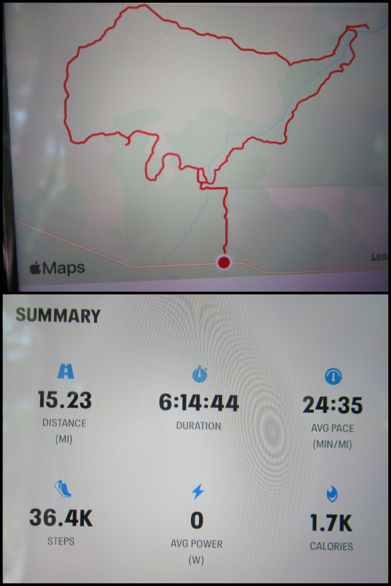
We picked a beautiful spring week to return to Myakka River State Park, to do the third loop of their long trail - the one outlined in red on the map below. The weather was gorgeous!


The road basically followed the boundary line north. When the fence turned east, we turned west. Although the road wasn't obvious (it probably gets washed out each year during the rainy season), someone had tied a few pink ribbons to some trees, and we made it through the forest without any difficulty, other than having to shoo dozens of feral hogs, yelling at them to get out of our way.


After about 1 1/2 miles, we found the trail intersection, and headed off to Panther Point Campsite, doing the loop counter-clockwise.


Panther Point Campsite
Shortly after the campsite, we connected with the Bobcat Crosstrail and retraced a section we hiked on our last visit. (You can read about the first loop we hiked here.)


Then we were off on new territory, a couple of miles through a gorgeous Florida prairie.

After entering this forested area, and according to Wayne's map, there should have only been 0.1 miles to the next turn-off. However, nothing appeared for another mile. We even turned around, but then noticed on my map (which must have been a different printing) that there was a longer mileage listed, so we turned around again.

It was incredibly comforting to come across this post!


Someday we'll come back to explore the East Loop, but this time we stayed on the Slough Crosstrail.

This section of trail must not get a lot of travel, so once again we were relieved to find the signs showing we weren't lost.

We were not relieved to notice this obstruction on the trail! When yelling and stomping didn't encourage the gator to move off the path, we bushwacked our way around it. That was hard work!


More trees, more signs, and even a creek to cross.


Morning vs. afternoon!
Before heading back to our car, we took one last little detour, checking to see if this was really a shortcut from the road to the trail. It was, so we'll take it next time.

The end!


Comments