Our last hike (the teal equestrian trail) at DuPuis was hot and muggy, but mostly dry. This one was nice and pleasant, but mostly wet. While not quite a swamp tromp, it was definitely a bog slog!
We parked at the Governor's House Picnic Area, then hiked a bit down the Loop 1 trail to find the Yellow Trail. We turned right and took the loop counter-clockwise. (It would have been helpful at the end of the hike if we had remembered we started the loop at Post 22. However, these are new posts, and they weren't marked on our map.)
It wasn't long before we hit water, of varying depths and lengths.
You'll see that the Yellow Trail (C) meets the Red Trail (A) and they head south together, but not west. However, whoever put up the new posts must not have gotten that memo! We followed the Yellow Trail markings all the way to the Equestrian Campground (from Post 16 to Post 2, with a couple of double-backs to 5 and 6!), which added about two miles to our 8 mile hike.
Post 18 the first time
Post 18 the second time.
Let's go the correct direction and head to Post 50!
Once at Post 50, though, you'll notice it says to turn left (or east) and head to Post 54. However, our map suggested we ought to continue going straigh (or south). Neither direction had an obvious trail, just a lot of overgrown grass. We gave their directions a try, but when we didn't see any yellow blazes, we retraced out steps and headed for the blazed tree we saw in the distance - the one that corresponded with our map. I guess not very many people take this trail.
Eventually we found a more obvious trail, and even some white blazes (Trail B) to go with the yellow ones. The markers for the
Loop Trail, though, left something to be desired. It's a good thing we weren't planning on following those.
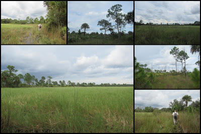
Wet, but beautiful, and eventually we did find Post #54!
Even though a trail wasn't marked on our map, Wayne wanted to try finding Post 50 from the other direction, so off he went. After a while he turned around, because even though this looks like a nice, grassy lane, he was really trudging in 6-8 inches of water. That's hard work! It also added another couple of miles to the total for the day.
You can actually see Post 52 from Post 54, which by this time was quite encouraging. Still a ways to go! The trail was wet, but the views were beautiful. Notice the afternoon thunderstorm building in the distance. Thankfully, although we heard thunder, the rain stayed in the distance.
By this time we were pretty weary. (Are we getting too old for hiking adventures!!??) And we had run out of water - shades of
Hot Springs. Normally I pack an extra bottle, but this was supposed to be a short hike, so I didn't. Next time I will! So, it was a relief to finally find some post markers again.
The hike wasn't over yet, though! I forgot that we had turned right, and not left, so we made a few wrong turns, and had to slog over that first river a couple more times. Fortunately, we finally got everything figured out properly and made it back to the car. But then, you already knew that; otherwise you wouldn't be reading this post.
Final log: 13.82 miles in 6:56:48 hours. You can see that we almost made the connection back to Post 50, and that several times we wandered trying to find the next blaze. Technology is pretty cool when it works. (The green dot is where we parked, and the red dot is where we remembered to stop the app on the drive home.) Next time we'll hike the Red Trail. Stay tuned to see if it will be during the wet season or the dry season.
Even tired hikers can smile at the end!


.JPG)


Comments