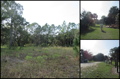
DuPuis Bike Hike
It was another beautiful fall day in South Florida when we set off to explore the bike trail at Dupuis Wildlife Management Area.
The sign said to go left, so we did. However, the sandy dirt road we followed sure didn't seem to be a bike trail! And when we arrived at Gate 1, we were positive we had hiked the boundary road and not the bike trail.
We found a horse trail, and that eventually led us to a few hidden bike trail markers!
One of the disadvantages of rarely used trails is the necessity of hiking through long grasses. That leads to collecting burrs! It took a fair amount of time, and some painful fingers, to remove them from our pants, but we succeeded. And I'll leave you with a picture of some of the beautiful flowers we saw along the way. Look for the roses and not the thorns in life!
But those petered out, so we followed the boundary trail again for a while.
Near the parking area we noticed another service road, so we explored it trying to find more red markers, and we did.
Maybe you'd have success riding a bike through this "jungle" but I wouldn't recommend it! Once again, we couldn't find any more bike markers, but there were horse trail markers, so we followed them to complete our circle.
Back at the beginning I looked harder and finally found the hidden bike marker that should have been the start of our hike.
It's there; look closely!
However, I'm actually glad we did what we did. We made some great memories, and that's really the purpose of these activities.
To recap, the plan was to park at Gate 2 and take the "pink" bike trail, supposedly a 2-mile loop. What we ended up doing was parking at Gate 2 (#1 in the picture) and following the boundary road to Gate 1 (#2). The we followed the dirt road (which leads to the fishing pond that we visited on our last visit) until it intersected with a horse trail (#3). After following the horse trail to the creek, we finally noticed a bike trail marker and followed that for a bit until the markers disappeared. Then we walked through the meadow back to the boundary road (#4). After returning to the parking area, we decided to take another "service" road to see if we could find the bike trail that way. We did (#5), and "bushwhacked" our way along it until once again the markers disappeared. However, we found the yellow-green horse trail blazes (#6) and successfully followed them back to the parking area.
Afterwards, we did some more exploring, taking the 12-mile dirt road to see how accessible the starting (or ending) point of a future hike might be. We had success reaching it this time; hopefully that will be the case next time. We'll let you know!


Comments